

Birgit Peterson (Early Adopter)
USGS Earth Resources Observation and Science Center
Evaluation of ICESat-2 ATLAS data for wildland fuels assessments.
Wildfire decisions; fire behavior modeling variables
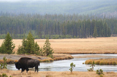
Among remote sensing instruments, lidar systems are uniquely suited for wildfire fuels mapping because of their ability to capture the 3D arrangement of canopy elements. Knowledge of this vertical and horizontal arrangement is critical to modeling fire behavior. As lidar data become more prevalent, focus is shifting from experimental use to operational integration for fuels assessments. The 3D organization of fuel is highly dependent on the structure of vegetation, which lidar is uniquely suited to assess remotely. Incorporating space-based lidar into a national mapping effort would allow for a much needed, large-scale data consistency required by the LANDFIRE program, a mapping effort that produces vegetation and fuel maps consistently and comprehensively for the entire US and that provides the current set of default layers for fire behavior modeling. The maps of fuels are extensively used by fire behavior analysts and land mangers strategically and tactically to assess potential fire behavior and develop fuel reduction plans.
We believe that the future ICESat-2 products will help extend the utility of our tool, Creating Hybrid Structure from LANDFIRE/Lidar Combinations (CHISLIC), by allowing for spatial extrapolation with newer data. CHISLIC is being developed in partnership with the Forest Service's Wildland Fire Assessment System, which will ultimately assume operational oversight of the application. Preparing now for the eventual release of the ICESat-2 data products will allow a more rapid adoption into the CHISLIC processing flow and, therefore, a more rapid incorporation of these data into wildfire decision making processes.
Kurtis Nelson, Science Lead, USGS Earth Resources Observation and Science (EROS) Center
U.S. Forest Service's Wildland Fire Assessment System; W. Matt Jolly, Program Manager, wmjolly@fs.fed.us