

For broadcast quality video and images, visit the ICESat-2 SVS gallery.

Join Paige & Pho with ICESat-2’s Dr. Nathan Kurtz to learn what’s going on with sea ice.

Timelapse video showing the ATLAS instrument being integrated with the ICESat-2 spacecraft. (2015)

Join Paige & Pho with ICESat-2’s Dr. Denis Felikson to learn what’s going on with ice sheets.


NASA utilizes advanced satellite lidar technology to better understand and observe Earth’s forests.
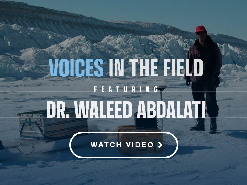
Dr. Waleed Abdalati uses satellites and in situ measurements to study polar ice. He takes us on a journey to the polar regions in this video. Waleed is the Executive Director of CIRES of the University of Colorado at Boulder. Waleed was formerly the NASA Chief Scientist (2011-2012) and previously the Head of Cryospheric Sciences at Goddard Space Flight Center (2004-2008). Waleed was heavily involved with the development of the ICESat and ICESat-2 missions.

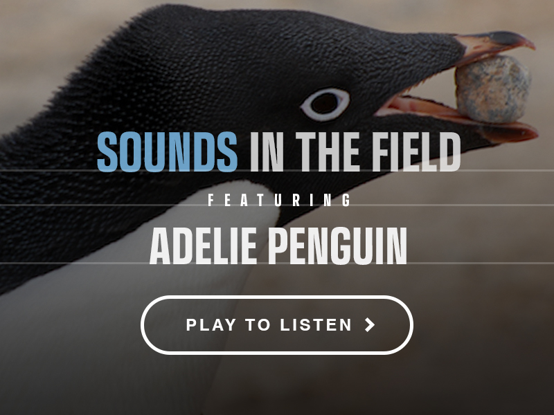
Experience the sounds and senses of the remote polar regions through NASA’s Sea Ice Scientist in the Field, Dr. Rachel Tilling. This recording is a complement to NASA’s latest tactile book: “Earth: A Tactile View of the Blue Marble.”
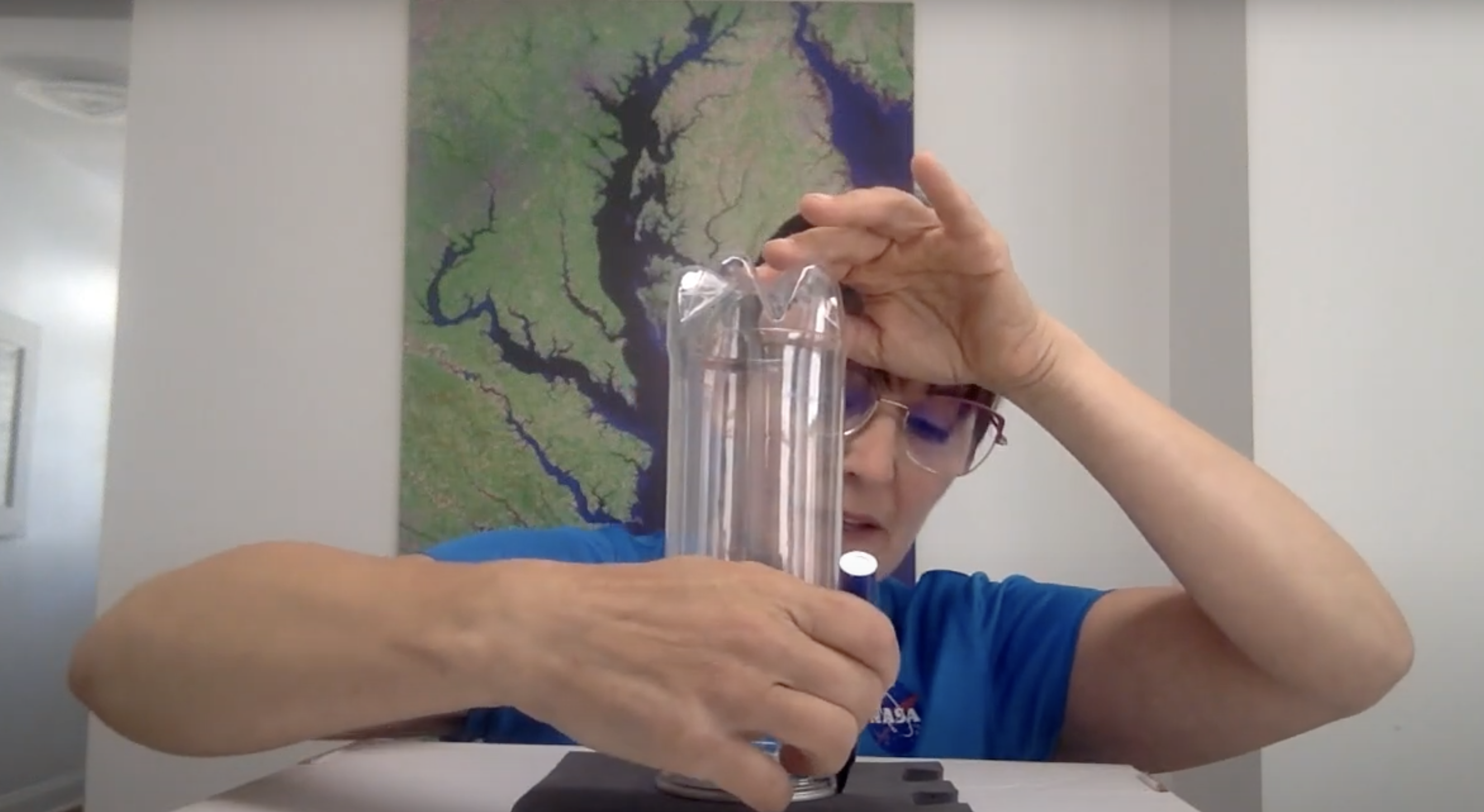
Valerie Casasanto, outreach manager for the Ice, Cloud, and land Elevation Satellite-2, or ICESat-2, demonstrates the "Motion in the Ocean" water density activity. The materials needed are tennis ball tubes, a tub or container for excess water, salt, food coloring, tubing or a clear straw (a disassembled pen body could also work), and high density foam (such as from a children's puzzle floor mat) to make the fluid separator plugs.
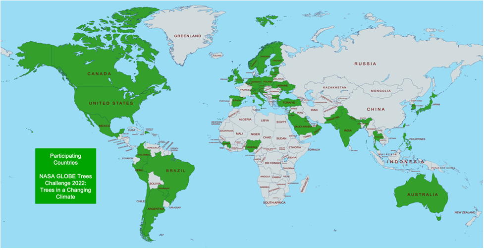
With 3.03 trillion trees and 78,000 tree species on Earth, we strive to build and update the global inventory of tree height observations. Tracking how trees change over time, both in height and in the number of trees that make up an area, is a good indicator of an ecosystem’s health in an evolving climate. Through a combination of ICESat-2 and the GLOBE Program, we can compare space-based tree height and ground-based tree height observations.
You can also see feature articles that stem from this blog at the Chesapeake Bay Foundation and NASA Science.
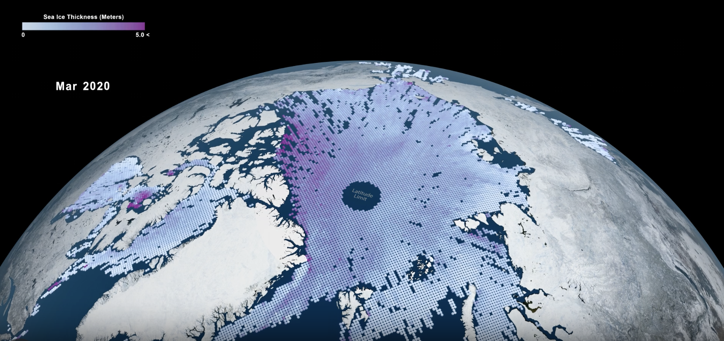
A view of the Arctic Ocean with ICESat-2 monthly average sea ice thickness data from November 2018 to April 2021. Low values are depicted in light blue, and higher values (5 meters) are depicted in magenta.

You can create an ICESat-2 Micro-environment model by using common things found around your house. The ICESat-2 Micro-environment allows you to identify the Earth objects that ICESat-2 can measure, the elevation of, from space.

This visualization depicts how ICESat-2 data is being used to study vegetation canopy.
For high resolution and different versions, visit the SVS Gallery here.
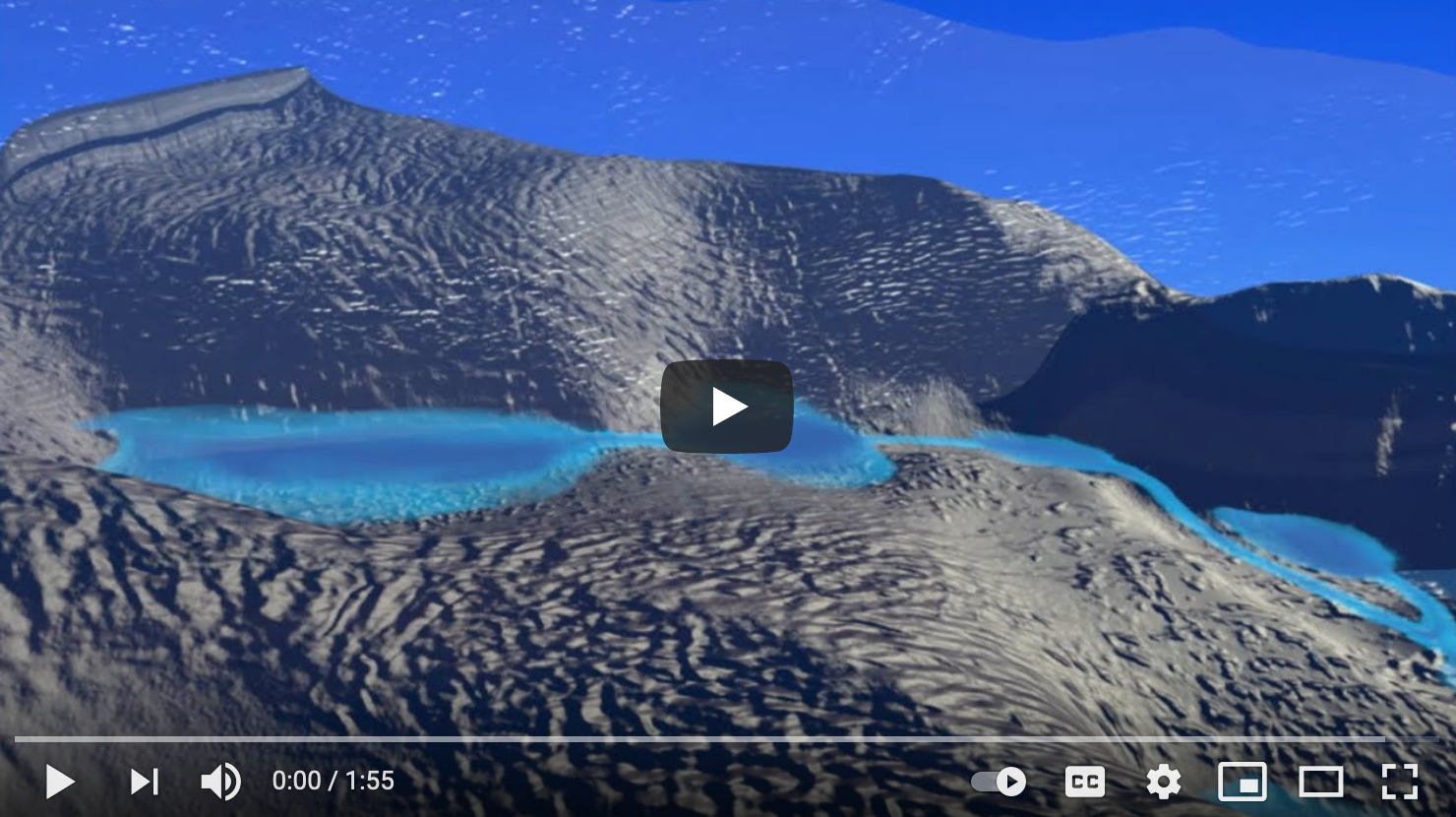
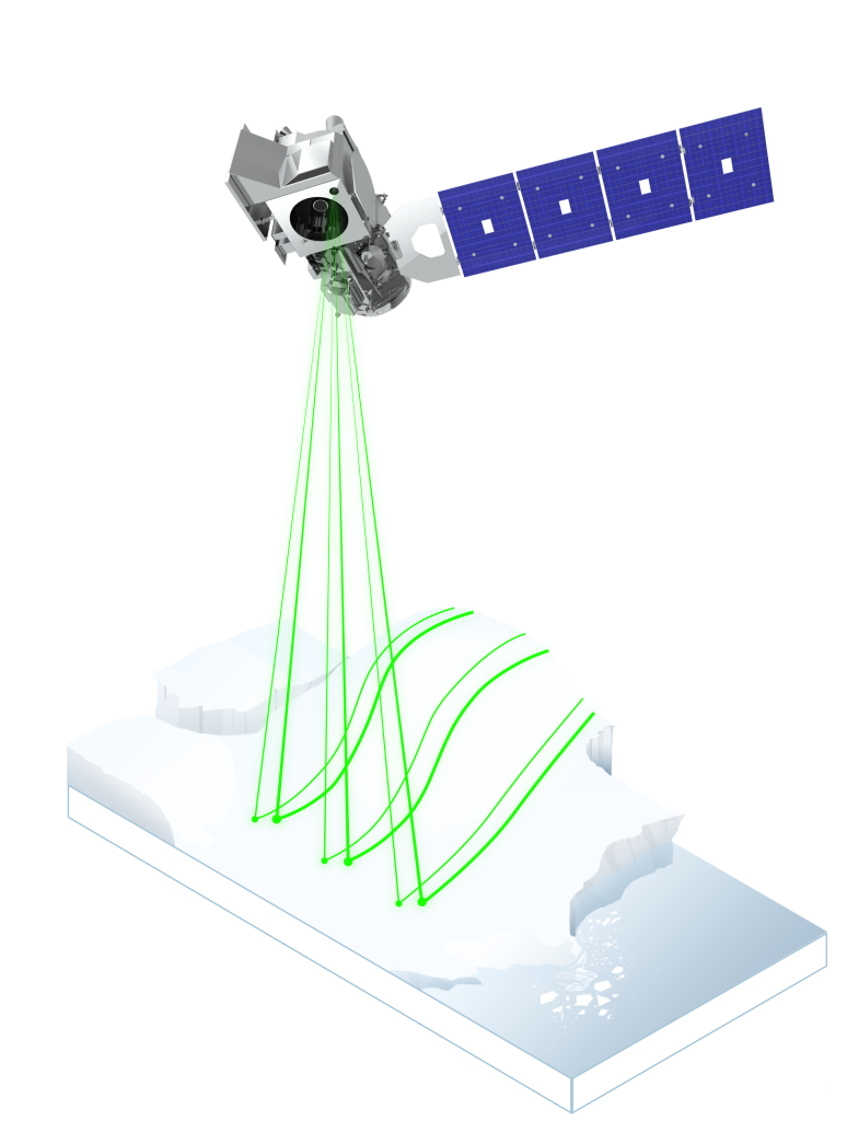
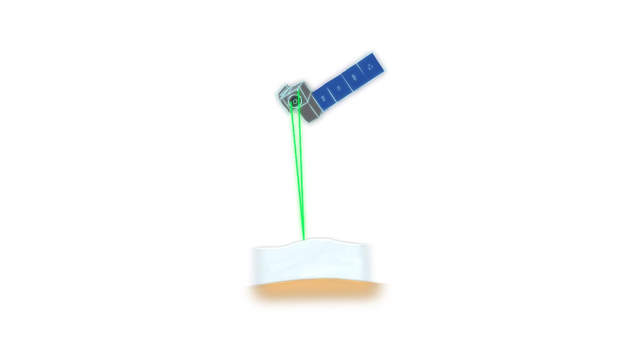
Hundreds of meltwater lakes hide deep beneath the expanse of Antarctica’s ice sheet. With a powerful laser altimeter system in space, NASA’s Ice Cloud and land Elevation Satellite-2 (ICESat-2) is helping scientists “see” under the ice.

Overview video of the Cryo2Ice Mission created by the European Space Agency. The orbit of CryoSat-2 has been slightly changed to align periodically with ICESat-2. This will provide almost simultaneous radar and lidar measurements over the same ice.

The "Breaking Down the Big Questions at NASA" video is a resource that can be used alongside any activity that involves creating and developing questions. While the video focuses on questions about trees, the basic principles are necessary for asking scientific questions. The video was created for students wanting to do student research projects, who often get tangled up in the onset of their research with things problems like "what questions can I answer?" and "how do I answer such a huge scientific question?" The video discusses how to answer large research questions by starting with a series of smaller, exploratory questions that can serve as a guide to the student research and to help answer the larger, seemingly very difficult research questions.

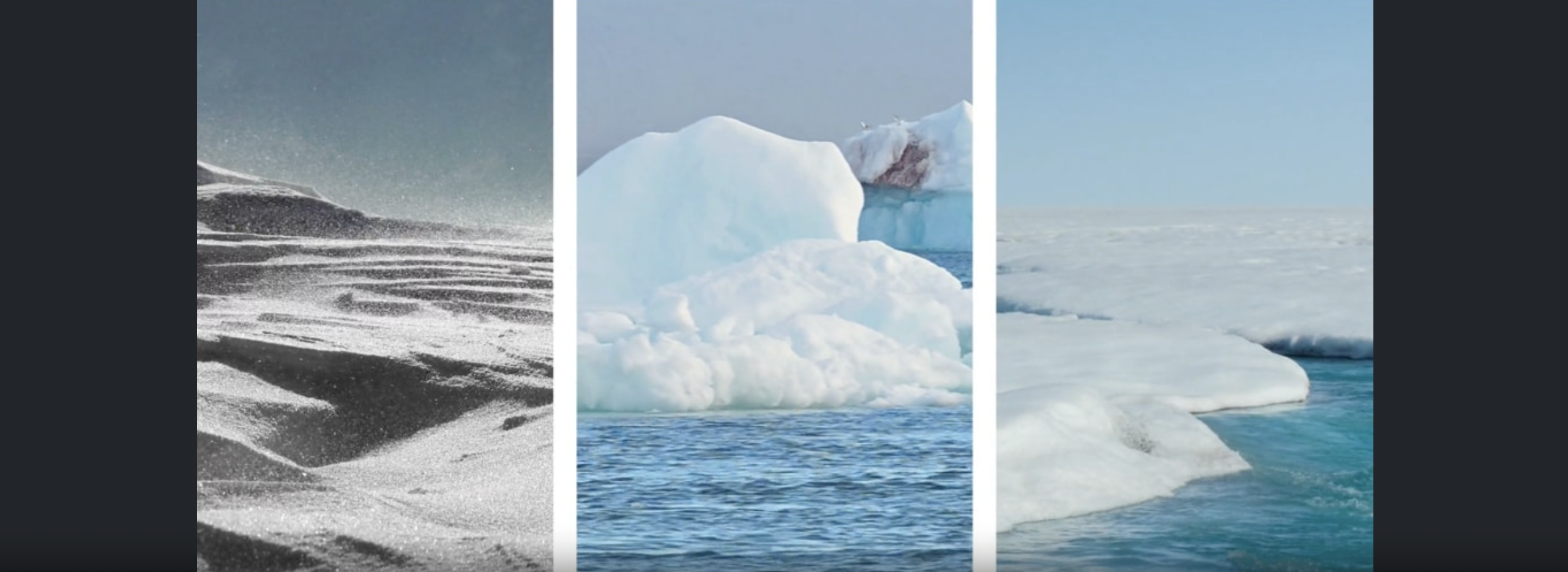
Earth’s seas are rising, a direct result of a changing climate. Ocean temperatures are increasing, leading to ocean expansion. And as ice sheets and glaciers melt, they add more water. Over 90 percent of Earth’s ice mass is locked up in Greenland and Antarctica. As our greenhouse gas emissions warm the planet, those areas, along with glaciers worldwide, lose more ice, contributing to sea level rise.
Check out this time lapse video simulating sea ice and land ice melting in an aquarium and its effect on sea level rise.
To learn how to recreate it for yourself using common items at home, click here.
Learn more about sea level rise on the NASA Rising Seas page.
Video Production Credit: Valerie Casasanto and Ryan Fitzgibbons
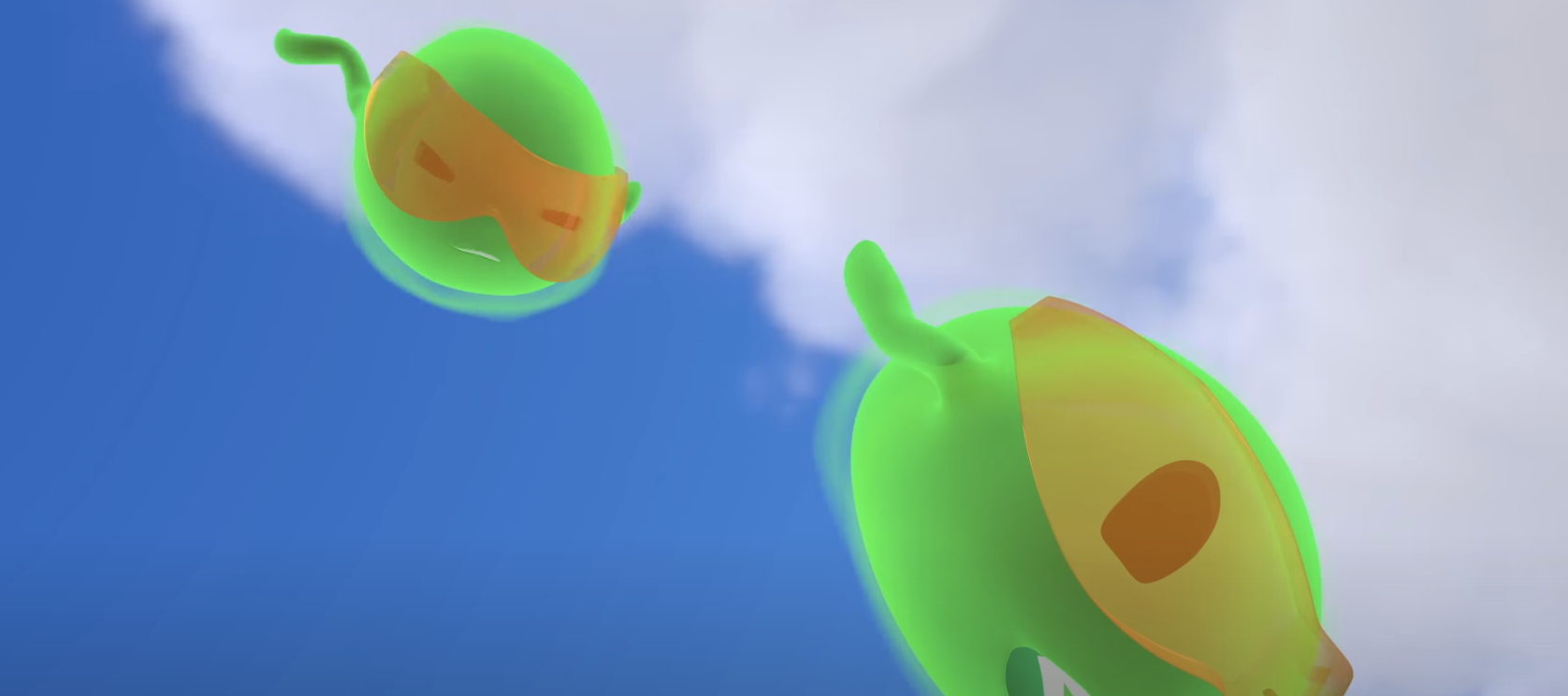
Pho, a plucky bright green photon of light, must travel from a NASA spacecraft down to Earth and back again to help complete a crucial science mission in this educational short film. The animation was created and produced by media art students from the Savannah College of Art in Design (SCAD) in Georgia, in collaboration with NASA’s Ice, Cloud and Land Elevation Satellite-2 (ICESat-2) mission.
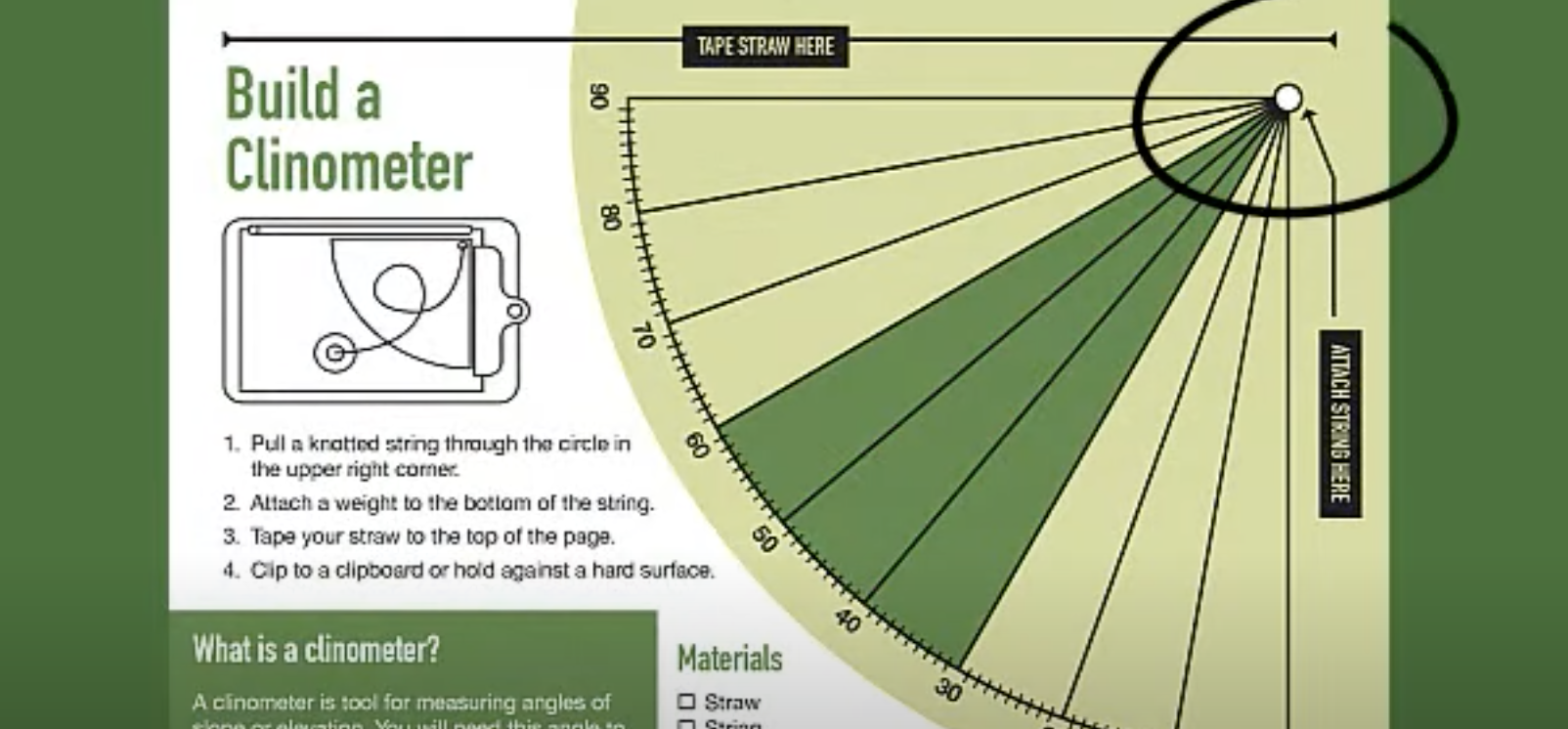
Brian Campbell, ICESat-2 education lead and science liaison and outreach lead for the NASA GLOBE Observer Trees Tool, and his son Andy, demonstrate how to make and use a simple paper clinometer to measure the height of trees. To do this activity, you will need a printout of the clinometer activity sheet, a straw, a pen or pencil, scissors, tape, string, and some sort of weight for the string such as a washer, nut or paperclip. A rigid surface such as clipboard or piece of cardboard may also be needed to attach the clinometer to as you are measuring the angle to the top of the tree.
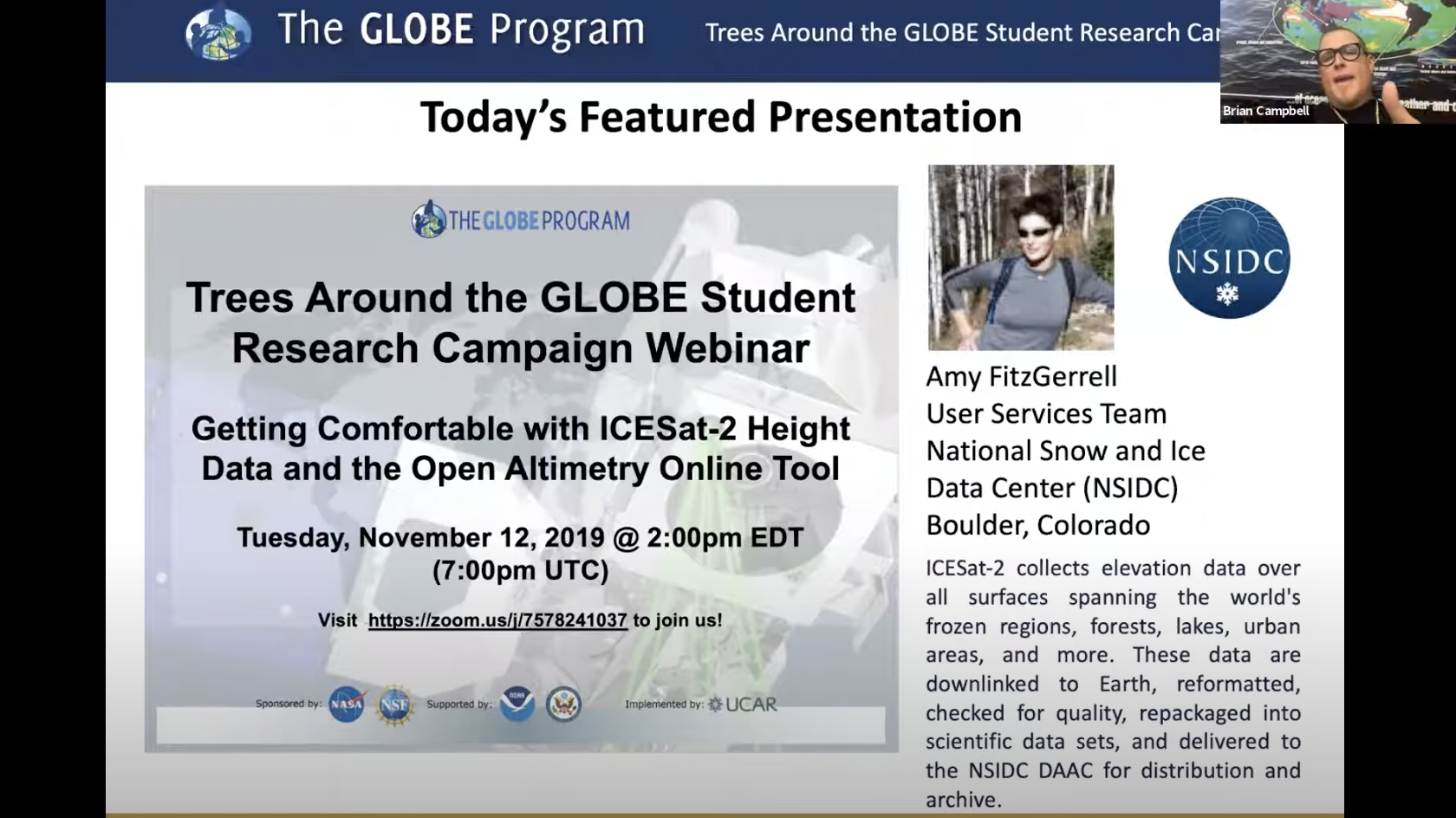
One of the major ways students can perform student research is to compare GLOBE student and citizen science tree height data to height data from the NASA Ice, Cloud, and land Elevation Satellite-2 (ICESat-2). By comparing this data, students can see just how close the satellite tracks over their locations and if certain GLOBE-measured trees have been measured by ICESat-2. Amy FitzGerrell, from the National Snow and Ice Data Center (NSIDC) in Colorado, guided us with an interactive tutorial of the Open Altimetry online tool.
View the video on YouTube
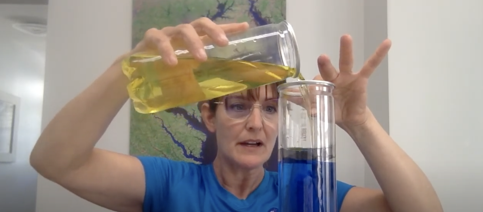
Valerie Casasanto, outreach manager for the Ice, Cloud, and land Elevation Satellite-2, or ICESat-2, demonstrates the "Motion in the Ocean" water density activity. The materials needed are tennis ball tubes, a tub or container for excess water, salt, food coloring, tubing or a clear straw (a disassembled pen body could also work), and high density foam (such as from a children's puzzle floor mat) to make the fluid separator plugs