

Airborne Data Outage
Airborne Data is in the process of being moved to NSIDC. Until that is completed, please contact Christine Sadlik if you require further information on any of these datasets.
Notice: These data are provided "AS IS" without any warranty of any kind, either expressed, implied, or statutory, including, but not limited to, any implied warranties of merchantability, or fitness for a particular purpose, or any warranty that the data will be error free. In no event shall the United States Government, or its contractors or subcontractors, be liable for any damages, including, but not limited to, direct, indirect, special or consequential damages, arising out of, resulting from, or in any way connected with this data, whether or not based upon warranty, contract, tort, or otherwise, whether or not injury was sustained by persons or property or otherwise, and whether or not loss was sustained from, or arose out of the results of, or use of, the data. The United States Government disclaims all warranties and liabilities regarding third party data, if present in the NASA generated data, and distributes it "AS IS."
In summary: These are research data! Please check occasionally for updates, and please let the investigator know about your findings. Your input will help to improve the data sets.
SIMPL
The Slope Imaging Multi-polarization Photon-counting Lidar or SIMPL, flew on campaigns in 2011 and 2015. For more information, see the SIMPL page.

MABEL
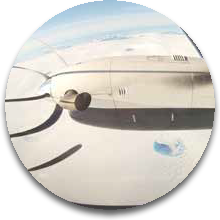
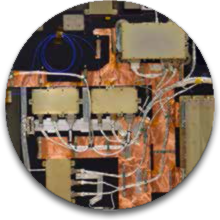
The Multiple Altimeter Beam Experimental Lidar, or MABEL, is a test-bed instrument for ICESat-2. MABEL has flown on several different aircraft, over terrain including Greenland’s ice sheets, the Arctic’s sea ice, the Chesapeake Bay and more. For additional information, see the MABEL page.
MATLAS
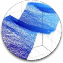
MATLAS data simulates the expected performance of ICESat-2’s ATLAS instrument, and is produced by adjusting MABEL data to be more similar to that expected from ATLAS. See more about MATLAS at NSIDC.
SIGMA SPACE SPL PROTOTYPE
At this link are vegetation and ice sheet data from Sigma Space’s Single Photon Lidar (SPL) Prototype Instrument, gathered on flights over Maryland, New Jersey and Greenland. Learn more on the SPL Page at NASA Spinoff.