

How does the Naval Research Laboratory Help Ships Navigate Through the Arctic?
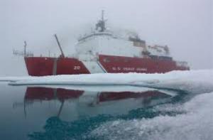
US Coast Guard Cutter Healy (Hansen/NASA)
Who Cares and Why?
Alaska’s 2011 “Storm of Epic Magnitude”, an extra-tropical cyclone that developed over the Bering Sea and moved across the western coast of Alaska, produced wind speeds that exceeded 80 miles per hour, storm surges of up to 10 feet, sea-ice laden waves reaching 40 feet high, and inland blizzards. The storm took one life and left a trail of destruction in its wake: severely eroded beaches, damaged homes and fish racks, as well as streets flooded and blocked with debris and thick plates of ice. The storm also left the harbor of Nome, the largest city in the Alaska’s Norton Sound, blocked with sea ice for several months, resulting in a potential fuel shortage. For the first time in its history, fuel was delivered to a Western Alaskan community through ice-covered waters—Russia’s T/V Renda carried the fuel, while U.S. Coast Guard cutter Healy broke ice to ensure a passage to Nome.
Since the 1950s there has been a rising frequency and intensity of arctic storms. This one storm magnifies the critical need for better forecasts of weather, ocean and sea ice conditions. Coastal communities not only depended on timely storm forecasts issued by the National Weather Service (NWS) to have ample time to prepare, but on the ice information provided the NWS Sea Ice Program, the National/Naval Ice Center (NIC) and the Navy’s Fleet Weather Center in San Diego to guide U.S. Healy and T/V Renda to Nome. Early warnings also permitted Alaska’s Division of Geological & Geophysical Surveys to improve the documentation of the event-specific changes, which has the potential to enhance future mitigation and adaptation efforts. The latest minimum summer sea ice extents (2007-2013) have been the lowest in satellite record since 1979. Arctic sea ice extent for September 2013 was 5.35 million square kilometers, the sixth lowest in the satellite record. Reductions in sea ice extent, duration and thickness have the potential to increase the frequency and amplitude of storm surge and increase the highly seasonal vessel activity in the Arctic.
Needed Measurement(s)
The U.S. Naval Research Laboratory (NRL) has an operational responsibility to provide daily updates of sea ice conditions to vessels navigating through the Arctic. One of two U.S Navy operational systems, the Arctic Cap Nowcast Forecast System (ACNFS) is a coupled sea ice and ocean model that provides nowcasts and forecasts of sea ice conditions in the Northern Hemisphere. Each day the ACNFS runs a 3-day hindcast to collect all of the satellite data produced within the last 72 hours, a nowcast, and a 7-day forecast, and produces an approximate 50 products, which include ice thickness, ice concentration, ice drift, snow convergence/divergence, rate of opening, sea surface temperature and ocean currents. ACNFS products are integrated in the forecast process of the NWS Sea Ice Program, and are used by the NIC, among other external customers, to provide the Navy fleet with daily ice forecasts. The NRL is interested in ice thickness and sea ice freeboard data for assimilation into the ACNFS or for model validation to improve ice edge forecasts for the entire Arctic Marginal Ice Zone (MIZ). Unity of low-latency lead identification can be applied by the NIC and other ice services to verify and track lead important to ship navigation in ice infested waters and to estimating water-air interactions.
The NASA Response
NASA’s Ice, Cloud and land Elevation Satellite-2 (ICESat-2) Early Adopter Program has coordinated engagement opportunities between ICESat-2 Science Definition Team (SDT) members and the NRL to foster a mutual understanding of how ICESat-2 products can benefit NRL’s data product needs. As an Early Adopter of ICESat-2 mission, the NRL will work with MABEL (Multiple Altimeter Beam Experimental Lidar) and mission simulated data products to better prepare for the real observation data after ICESat-2 launches. Over the next 2 years, the NRL will work with the ICESat-2 SDT to prepare ACNFS for the mission data products and provide feedback to the ICESat-2 mission about challenges and gains they experience as Early Adopters of prelaunch mission data.
This communication is geared to enhance knowledge of how data will be used during the development stages of the data algorithms and inform the mission scientists of how the mission data products may perform in real world applications. NRL believes that ICESat-2 products will provide a unique opportunity to evaluate the ACNFS performance. NRL expects that the ICESat-2 Global Geolocation Photon Data and the Arctic Sea Ice Elevation products will provide a unique training data set for their MIZ retrieval algorithm and sea ice model—expanding the MIZ ice edge validation to the entire Arctic domain. NRL would use the 21-day and 45-day old products for validation, but believes it may be able to improve the real-time system for ice thickness even with 45-day latency data.
Comments? Thoughts?
The ICESat-2 Applications website (https://icesat-2.gsfc.nasa.gov//applications) provides information on the Early Adopter program. Readers can attend applications events (e.g. workshops, focus sessions and tutorials) or join our community listserv (https://lists.nasa.gov/mailman/listinfo/icesat-2-applications/) to stay informed about future activities. For additional information about ICESat-2 mission applications or this particular application, please contact ICESat-2 Applications Team at: icesat-2-applications@lists.nasa.gov.