For more Information and to register for this webinar, follow the link below:
https://www.earthdata.nasa.gov/learn/webinars/laser-altimetry-applicati…
NASA's Ice, Cloud, and land Elevation Satellite-2 (ICESat-2) was launched in September 2018 to measure the heights of all surfaces across the globe, including land ice, sea ice, oceans, water, and vegetation. ICESat-2 carries a photon-counting laser altimeter to measure these surfaces, providing measurements every 70 centimeters along the platform’s ground path at a rate of 10,000 laser pulses per second. NASA’s National Snow and Ice Data Center Distributed Active Archive Center (NSIDC DAAC) distributes ICESat-2 data products in the NASA Earthdata Cloud, along with an abundance of learning resources for users to visualize, access, and customize each data product.
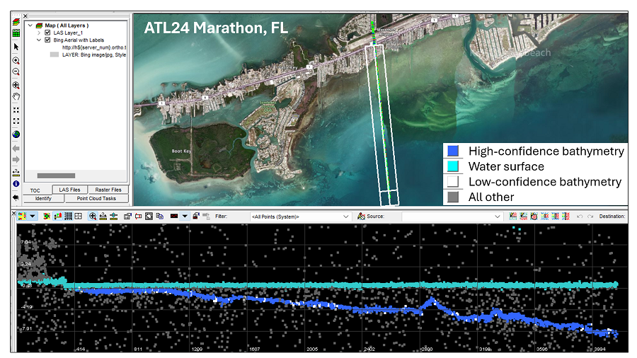
In this webinar, we will cover a new global ICESat-2 bathymetric data product, ATL24, including results of an ATL24 accuracy test. We will then present use cases, including training models for extracting bathymetry from multispectral imagery and identifying hazards to marine navigation. We will also demonstrate a public web application programming interface (API) for processing ICESat-2 data in the cloud.